Geonics EM34 Suggestions and Common Problems
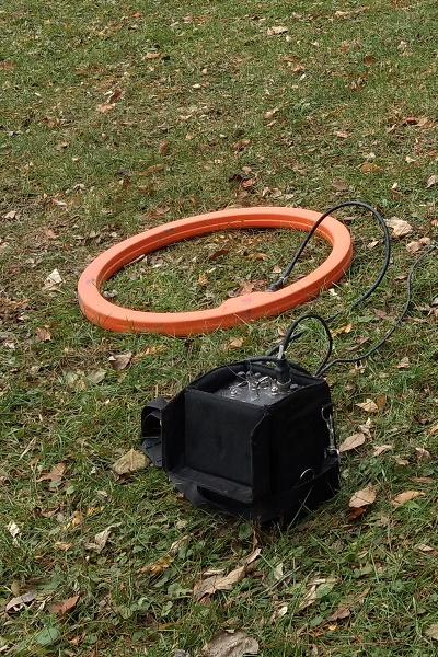
Geonics EM34-4
The EM34 is an electromagnetic conductivity meter that measures apparent in millisiemens per meter for deep exploration such as mapping deeper groundwater plumes, potable water, fractures, faults, etc.
EM34 Configurations:
The EM34 comes in two different variations:
EM34-3: The EM34-3 made by Geonics possesses three intercoil spacings: 10, 20, and 40 meters. This allows a depth of investigation of approximately 15 meters (49 feet,) 30 meters (98 feet,) and 60 meters (196 feet) in the vertical dipole and approximately 7.5 meters ( 24.5 feet,) 15 meters (49 feet,) and 30 meters (98 feet) in the horizontal dipole. The vertical dipole (horizontal coplanar) is very sensitive to vertical geologic anomalies and therefore often used to find fractured and faulted bedrock as well as groundwater.
Unlike the other Geonics conductivity meters, the EM34 does not measure magnetic susceptibilty although an optional modification can be installed to include this feature.
EM34-3XL: The EM34 is very sensitive to cultural and atmospheric noise so Geonics created the EM34-3XL to deal with areas where more power and a larger transmitter is needed to collect accurate results where conditions are less favorable. The increased power and larger transmitter improves the signal to noise ration by a factor of 10 at the 40 meter spacing, and by a factor of 4 at the 10 and 20 meter spacings.
EM34 Considerations
Given that the EM34 consists of two large hoops, the TX and RX coils, the EM34 is bested suited as a two man operation. Usually, one person carries the transmitter and transmitter coil while the other person carries the receiver and receiver coil. The apparent conductivity readings, coil separation, and data logger output are all located on the receiver end so the more experienced operator usually controls this end.
Since the coil spacing is not fixed like Geonics’s other electromagnetic equipment, the user with the receiver needs to watch the Separation Display and ensure that it reads close to zero. Remember, depth is determined by the spacing so accurate coil separation is paramount to reach the desired depth of exploration. Tolerances ranges for accurate separation are determined by the scale being used. Reference the manufacturer’s manual to see these values.
The EM34 is vulnerable to environmental and cultural noise such as radar installations, TV and radio towers, power lines, and nearby metal objects. Items such as keys, belt buckles, cell phones, pocket knives, and other metal objects need to be removed from the user before operation.
Once an area is found free of noise, an area that can be revisited should be found for calibration. This area should be free of any nearby metal. Check both the battery level in the transmitter and receiver. Let the equipment warm up for 10-15 minutes before any other checks to ensure that battery decay doesn’t affect readings. Absolute zero and the separation function can be checked in this area following the manufacturer’s recommendations. Note the apparent conductivity reading in this area to compare it each time a new day or survey is started
When conducting a survey, it is important to lay the hoops flat with the red dots in the same orientation while in the vertical dipole. In the horizontal dipole, the user wants to make sure the coils are plumb and the red dots are in the same orientation. It may be a good idea for the user to mark the center of the cables to ensure the operators are measuring the correct point, or station.
Power and Battery Problems
After setting up the equipment, the transmitter’s battery power can be checked by setting the Level Switch to Normal and switching the Power to On. Make sure no metal is nearby. The battery indicator needle should move right to the green status area.
If in the red status area, there are a couple of things to check. Open the transmitter and make sure the batteries are receiving proper contact. If the contacts are not tight, take the batteries out, pinch the contacts to tighten them, and reinsert the batteries. Check for corrosion. If there is any corrosion, remove the batteries and use fine steel wool to rid the contacts of grime. After making sure the contacts are clean and making contact with the batteries, recheck the battery power. If still in the red status area, replace eight D batteries.
The EM34 receiver is powered by eight C batteries. To check the battery switch the Separation Switch to BATT to switch the power to ON. The right digital display on the right side will display a value. If lower than +/- 4.5 volts, replace the batteries.
Grid or GPS
One of the most important decisions the user needs to determine is whether to do a grid survey or gps survey.
Grid surveys can be useful in areas that don’t require or cannot receive GPS signal. The downside is that it usually takes about as long to set-up a grid survey as it does to collect the data. Grid surveys consist of lines with stations. At each station, a trigger is depressed and a readings is manually taken. Lines can be collected in all one directions or bi-directionally. Setting up visual flagging or sight points may be important to keep on a line and station point. Sometimes GPS may still be helpful to mark corners, areas or interest, and sight points so a survey can be revisited or inserted into mapping software.
When GPS is used, survey setup is much quicker since sight points and survey marks are a little less important. Readings with a GPS can be taken manually or continuously in Auto Mode. Taking readings in the Auto mode in the horizontal dipole is much easier than the vertical dipole since the coils need to be flat on the ground. It may be best to stick to Manual mode for the vertical dipole.
Whether doing a grid or GPS survey, its important that the users keep the coil spacing correct. This means the operator with the receiver will need to keep track of the Separation display and make sure the hoops aren’t too close or far away. If taking readings with multiple separations at a given station, careful note-taking must occur, and both the receiver and transmitter operators must switch the Reference Cable to the correct separation. Again, the RX operator will need to keep track of the Separation values.
Common EM34 Problems and Solutions
The instrument won’t log.
- Is the receiver turned on? Is the transmitter turned on? Are the batteries low?
- Is the instrument connected via data cable? Are the connections fully seated at both the data logger and instrument?
- Is the data logger cable connected to the assigned Com Port in the Logger Setup menu? Is there a conflict between the assigned data logger com port and assigned GPS com port?
- Is the data cable bad? Did the user try replacing it with the spare?
- Is the instrument enabled in the Logger Setup menu?
- Did the user create a data file and select “Go”?
- Did the user try powering the instrument and data logger off and turning it back on?
- If all the above looks correct, the instrument’s data logging INI file may be corrupted. Locate this initialization file and delete it. This file is often in a folder called GEOINI and will have the same name as the logging program followed by the extention “.ini” When this file is deleted, it will reset the data logging program to defaults and all modifications that were changed before the survey will need to be changed again.
The instruments readings don’t change or are maxed out.
- Are the batteries low on power? Did the operator check the battery power on the RX and TX after letting the equipment warm up for 10-15 minutes? Replace the batteries as needed.
- Are the batteries receiving good contact to the battery connectors? If the apparent conductivity is maxed out and will not move, this is often a sign that one of the connections on the batteries is not very good. Remove all the Receiver and all the Transmitter batteries. Pinch the connectors so I tighter battery connections will occur. Reinsert all the batteries and give them a “spin” while inside the battery cradle. Reevaluate.
- Is there environmental noise that the instrument is encountering? Is there another source of electromagnetic noise? Sometimes the only method of checking this is to pack up the instrument, move 5-10 miles, and retest the equipment.
- Are all personal metal objects removed from the user? Many users forget to remove their keys or cellphone!
- Was the instrument sufficiently warmed up and calibrated in an environment free of noise?
- Was absolute zero checked? Was the Separation function checked?
- Does the Reference Cable knob on both the RX and TX match the length of cable being used?
- Is the scale being used indicative of the general area being surveyed?
- Is the site too resistive? Would electric resistivity imaging be a better method?
- If all the above looks correct, the instrument’s data logging INI file may be corrupted. Locate this initialization file and delete it. This file is often in a folder called GEOINI and will have the same name as the logging program followed by the extention “.ini” When this file is deleted, it will reset the data logging program to defaults and all modifications that were changed before the survey will need to be changed again.